Wednesday, September 12, 2007

[03] Who Settled in OR pre-1950?

NativesChinook Indian
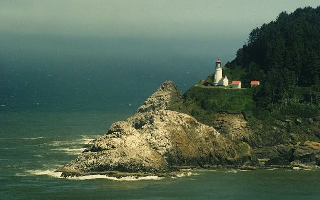
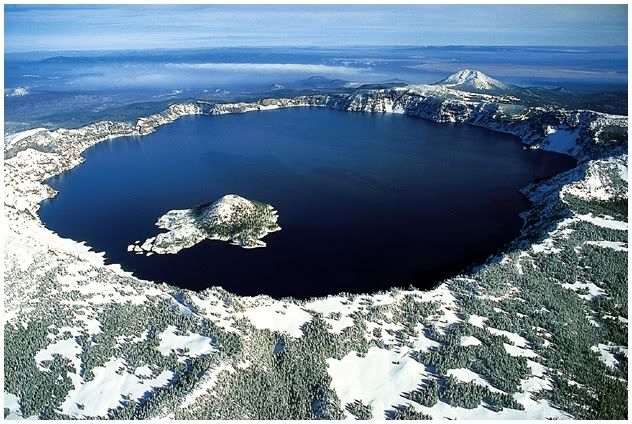
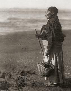
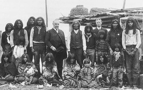
The first peoples to inhabit the area were nomadic hunter-gatherers that lived in small bands. Native tribes that settled in Oregon include the Chinook (pic to right), Tillamooks, and Nez Perce (to name some familiar ones). The ones on the coast took part in fishing activities where food was stored and harvested in summer and fall. The Chinookans carved canoes and made wooden spirit figures at grave sites. The Tututni and Chetco of the south coast bartered for raw materials. Western Oregon Indians had connections of trade and commerce reaching into northern California and to coastal Washington and British Columbia. They were involved in the flow of dentalium shells, elk hide armor, slaves, and surplus foods. Their lifeways echoed the strong traditions of art, ceremony, social class distinction, emphasis on wealth that ran for hundreds of miles along the North Pacific Coast.

The people living between the Cascades and Rocky Mountains fished, gathered fruit, and hunted deer and elk. They had to rely on seasonal migration between rivers and upland areas. Their environment included summers that were hot and windy and winters that were cold and windy. Women picked berries in the nearby mountains and men ran down deer in the snow to secure meat and hides for clothing and moccasins. They dipped, clubbed, netted, and speared salmon and wind-dried them in curing sheds along the river.

The peoples of the Great Basin traveled in extended family groups or as bands for communal hunts. Great Basin residents had a mixed economy. They hunted, fished, trapped, dug, and picked food resources. They moved based on the seasons to search for subsistence.


Nez Perce Tribe

Nez Perce Indians


The first official recorded visit of the Oregon coast is in 1792 by Robert Gray. He was an American trading captain who came upon the Columbia River. His find was further investigated by William Broughton, a British Army lieutenant. He sailed up the Columbia River George. Eventually, a fur trade grew in the area between American and British entrepreneurs and native peoples. Such things they traded were beaver and sea-otter pelts, tools, weapons, and cloth.

By 1805, Lewis and Clark explored the area and found the site of present day Astoria. After their journey, many white pioneers (fur trappers and traders) came to claim the land for the US. Around the 1840s, many people began to pour into OR. Pioneers came from the east coast Border States and merchants came by ship lead to the population explosion that lead to the development of the OR Territory in 1848 and eventually statehood.


Photo Sharing and Video Hosting at Photobucket


The British Hudson's Bay Company, led by Dr. John McLoughlin, became the dominant force in the economy. This fur-trading company directed activities throughout the region and built the original capital of the Oregon Territory in Oregon City at the northern end of the Willamette Valley. In 1846, the British renounced claims in the area when signing the Oregon Treaty.

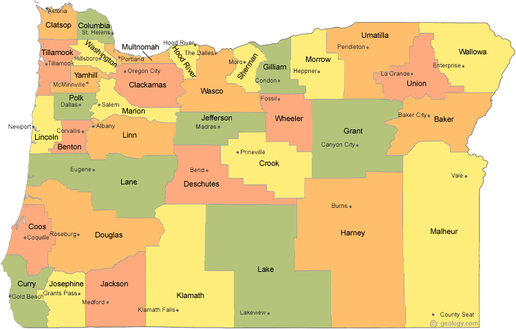
A major migration into the area happened in 1843 when pioneers traveled the Oregon Trail to settle in the Wullamette Valley. They depended on agriculture to make a living and wheat became a staple. In 1851, US surveyors divided the land into townships. This land measures 6 miles on each side, divded up into 36 sections, and each section had 640 acres.

In the 1870s, railroads were extended into the state. Waterway use became ineffective because of the availability of transport over the land. When automobiles were manufactured, the urban growth of the state began. Because of Oregon’s lush forestry, the logging industry came and the majority of logging activities take place in the state to provide for the rest of the country.


Sources
History of Oregon
Oregon Blue Book
General Oregon State History
Travel Guide: Fodor's Pacific Northwest

[04] Population Factoids Since 1950

Most people live in the Portland area and Willamette Valley area, especially around Salem and Eugene. The city of Portland had an estimated 539,438 residents in 2002 and the estimated population of Salem was 140,977; Eugene's was 140,395.

Population Trends
1980: 2,633,105
1990: 2,842,321
2000: 3,421,399
2004 estimate: 3,594,586

Percent change, 1990–2000: 20.4%

U.S. rank in 2004: 27th

Percent of residents born in state: 45.3% (2000)

Density: 35.6 people per square mile (2000)

Between 1970 and 1980, the state's net gain from migration was about 341,000; from 1980 to 1983, however, the state suffered a net loss of about 37,000, and from 1985 to 1990, the net migration gain was 123,500. Between 1990 and 1998, Oregon had net gains of 260,000 in domestic migration and 58,000 in international migration. In 1998, 5,909 foreign immigrants arrived in Oregon; of these, the greatest number, 1,879, came from Mexico. The state's overall population increased 15.5% between 1990 and 1998, making it one of the fastest growing states in the nation. In the period 1995–2000, 399,328 people moved into the state and 324,663 moved out, for a net gain of 74,665, many of whom came from California.

Racial and Ethnic Characteristics (2000)
White: 2,961,623
Black or African American: 55,662
American Indian and Alaska Native: 45,211
Asian: 101,350
Native Hawaiian and Pacific Islander: 7,976
Hispanic or Latino (may be of any race): 275,314
Other: 144,832

About 55,662 blacks were estimated to live in Oregon in 2000, up from 46,000 in 1990; most blacks reside in the Portland area. In 2000, Hispanics and Latinos numbered about 275,314, or 8% of the state total population, up from 113,000 in 1990. In the same year Asians numbered 101,350. There were 20,930 Chinese, 12,131 Japanese, 12,387 Koreans, 10,627 Filipinos, 18,890 Vietnamese (up from 8,130 in 1990), 9,575 Asian Indians (more than triple the 1990 population of 2,726), and 4,392 Laotians. Pacific Islanders numbered 7,976.

Age Characteristics (2000)
Population under 5 years old: 223,005
Population 5 to 19 years old: 720,999
Percent of population 65 years and over: 12.8%
Median age: 36.3 years (2000)

Vital Statistics
Total number of births (2003): 45,911
Total number of deaths (2003): 30,973 (infant deaths, 270)

Religion
Oregon has a high proportion of religiously-unaffiliated and self-identified "nonreligious" residents. 1.2% of Oregonians describe themselves as and 17% of Oregonians classify themselves as "nonreligious". The largest religion in OR is Christianity. Most people are part of the Catcholic Church, the Church of Jesus Christ of Latter-day Saints or the Evangelical Lutheran Church in America.


Sources
http://www.city-data.com/us-cities/The-West/Oregon.html

[02] Physical Landscape

Physiography
There are 6 major areas in OR: the Coast Range, the Willamette Lowland, the Cascade Mountains, the Klamath Mountains, the Columbia Plateau, and the Basin and Range Region.

The Coast Range runs from north to south along the Pacific Ocean. Oregon has over 400 miles of public coastline. Its terrain varies from cliffs to forests to sharah-like dunes and sandy beaches. There are many lighthouses, coastal lakes, & state parks loacted on the coast. The mountains are covered with spruce, fir and hemlock. The average mountaintop in the Coast Range rises less than 2,000 feet above sea level. Along the coast, cliffs rise almost 1,000 feet high over the Pacific Ocean.


**About 1/10 of the nation's timber resides in the state of Oregon and it leads in lumber production in the states.

The Willamette Lowlands are a narrow strip of land to the east of the Coast Range along the Willamette River. The Willamette River flows north into the Columbia River. The soil is rich in the Willamette Lowlands and the climate is mild.

To the east of the Willamette Lowlands, the Cascade Mountains rise 11,239 feet above sea level (Mount Hood). Many of the nation's highest peaks can be found here. Other high peaks include Mt. Jefferson at 10,497 feet above sea level, Three Sisters, over 10,000 feet above sea level, and Mount McLoughlin, 9,495 feet high. Many lakes can be found in the Cascade Mountains, such as Crater Lake (Pic on right).


The Klamath Mountains (pic below) are located in the southwest and they are covered by dense forests.


Most of eastern Oregon is the Columbia Plateau. The Columbia Plateau (pic on right) was formed by lava flowing from cracks in the earth's crust. Many wheat farms are found here. Much of the Columbia Plateau is quite rugged, and mountains such as the Blue Mountains and the Wallowa Mountains rise in the northeast. On the Oregon/Idaho border the Snake River has cut Hells Canyon deep into the earth. The average depth of this gorge, located between the Wallowa Mountains and the Seven Devils Mountains in Idaho, is 5,500 feet.

The Basin and Range region is located in southeastern Oregon, marked by high basins and a few steep mountains. It is mainly characterized by semi-desert conditions.

Above info provided by NETSTATE.

Climate
States in the Paficic Northwest have a reputation for quickly changing weather patterns. Oregon's is known for having rainy conditions, especially during the winter. However, that is not always the case during the other parts of the year.

Oregon's average yearly precipitation, from 1961 to 1990, is detailed by Oregon State University. (click to enlarge)


Western Oregon experiences mild winters due to moist, mild ocean winds. Its summers are also mild, with the west and central area cooler than the rest of the state. Summers are usually mild and warm. Precipitation various throughout the state. Normally, the southeast is dry and the west gets rains.

Much of the state is considered a desert, and the area west of the Cascades gets the most rain. Beginning on the east end, Oregon begins as a high, sage-scented desert plateau that covers 2/3rds of the state. Moving west, Oregon's landscape rises to alpine peaks, meadows, and lakes; plunges to fertile farmland and forest; then ends up at the cold Pacific Ocean.

Mean temperatures average 38 degrees in January, near 67 degrees in July. Cooler summer temperatures are common in the east and southeast, and in the Cascade Mountains. It's a bit warmer than normal in the southwestern corner of the state. (World Atlas.com)


Average highs and lows for selected OR cities


http://www.ustravelweather.com/weather-oregon/


Precipitation amounts vary from 8 inches annually in the drier plateau regions east of the Cascades, to as much as 200 inches in the higher elevations of the Coast Range mountains. Snow amounts approach 350 to 550 inches annually in the Cascades. (World Atlas.com)


Check out current weather conditions in:

Click for Forecast
Click for Forecast

For a more detailed report on OR's climate, visit Oregon Climate Service.

Tuesday, September 11, 2007

[01] About the Beaver State


Outline of the state of OR

395 miles wide (east to west at widest point)
295 miles in length (north to south at longest distance)


Capital
Salem

Largest City
Portland (City of Roses)

Statehood
February 14, 1859 (33rd state)
**notice something peculiar about the date? Valentine's Day!**

Timezone
Pacific Standard/Daylight Time

Flag
Oregon is the only state with a double-sided flag. Its colors are navy gold and blue, representative of Oregon's state colors. The 33 stars on the front of the flag represent the number of states at the time of statehood admission. Ships are representative of trade and the eagle is a symbol of the United States. The back has a beaver, which is Oregon's state animal.


State Name Origin:
The exact name origins of Oregon are unknown, but there are several beliefs on how it came to be.

It is believed to come from the French Canadian word "ouragan" meaning "storm" or hurricane" or possibly the Spanish word "orejon" meaning "big-ear" or the Spanish word "oregano" for the wild sage that grows in the eastern part of the state.

... According to SHG Resources ...

The first written record of the name "Oregon" comes to us from a 1765 proposal for a journey written by Major Robert Rogers, an English army officer. It reads, "The rout... is from the Great Lakes towards the Head of the Mississippi, and from thence to the River called by the Indians Ouragon. ..." His proposal rejected, Rogers reapplied in 1772, using the spelling "Ourigan."

The first printed use of the current spelling appeared in Captain Jonathan Carver's 1778 book, "Travels Through the Interior Parts of North America 1766, 1767 and 1768." He listed the four great rivers of the continent, including "the River of Oregon, or the River of the West, that falls into the Pacific Ocean at the Straits of Annian."

Historians say Oregon was most likely named after one of two rivers. The Columbia River, which forms a coastline along the northern border, was at one time called the Oregon or Ouragan, which is French for hurricane. Others believe the name was derived from a mapmaker's error in the 1700s. The Wisconsin River was named the Ouisconsink and was picked up by travelers referring to the country west of the Great Lakes as Ourigan.


Population
2006 estimate: 3,700,758 (US Census)

Size
Land area: approx. 95,997 sq miles

Location
Coordinates: 44.924N, 123.022W

Geographic Center: approx 25 miles to the southeast of Prineville, in Crook County

Highest Point: Mount Hood @ 11,239 ft.
Lowest Point: Sea Level on Pacific Coast


# of Counties: 36


Deepest Lake in the US: Crater Lake (Klamath County). Depth of 1,932 feet.


State...
Motto: "She flies with her own wings."

Animal: Beaver

Fish: Chinook salmon

The State Quarter


Oregon was the 3rd quarter to be released in 2005. The coin shows off Crater Lake, and it includes Wizard Island and Watchman and Hillman Peaks on the lake’s rim and conifers.

Other Interesting Facts
1. Oregon has more ghost towns than any other state.

2. Oregon and New Jersey are the only states without self-serve gas stations.

3. Eugene was the first city to have one-way streets.

4. At 329 feet, the Coast Douglas-Fir in Oregon is considered the tallest tree in the state.

5. At 8,000 feet deep, Hells Canyon is the deepest river gorge in North America.

6. The hazelnut is Oregon's official state nut. Oregon is the only state that has an official state nut. The hazelnut is also known as the filbert.

7. The nation's most photographed lighthouse is the Heceta Head Lighthouse located in Lane County.

8. Tillamook is home to Oregon's largest cheese factory.

9. The Columbia River forms most of the northern border between Oregon and Washington. The Snake River forms over half of the eastern boundary with Idaho.

More facts can be found at 50 States Facts